 Gael Point-Clos (A-31)
Validation date: 31 01 2014
Updated on: 31 01 2014
Views: 5566
See on the interactive map:
48°05'04"N 002°11'32"W
Airfield dimensions: 1000x1100meters
runway: 08/26 - 1200m/4500x120ft - grass (ALG)
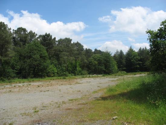
Gaël airfield, (french: aérodrome du Point-Clos or Advanced Landing Ground A-31 'Gael') was an airfield 345 kilometers west of Paris.
The history of Gaël/Point-Clos airfield began in 1921, when the community of Gaël transferred the property to the French state. As part of the deal, the city of Gaël was connected to the water grid. From 1925, the French War Ministry began using the airfield as the base for an isloated squadron. The installation covered about 100 hectares. Administratively, the base was a sub station of Base Aérienne 131 Tours. Besides 3 large hangars, the base provided ample room for the officers and troops. A 2000 liter bunker provided fuel for the aircraft.
For several years, Point-Clos was the only airfield in the west of France. In the 1930s, the airfield held several air meets and it became one of the places to land during the Interbellum.
On 14 December 1930, Point-Clos was the location where the return flight of the French aviators Costes and Bellonte landed after their flight from America. 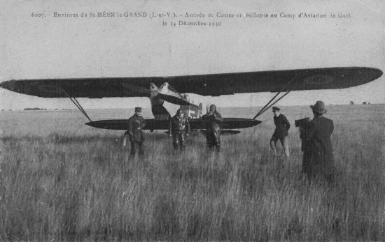
Arrival of Costes and Bellonte at Point-Clos on 14 December 1930 (collection Michel Muret, via Philippe Saint-Marc)
Aerial view (from the south) of Point-Clos in 1936 (via Philippe Saint-Marc)
When war broke out in 1939, the airfield experienced a resurge in activity. The Armée de l'Air stationed the 31 Bomb squadron 'Tours' and the observation squadron 'Chartres' at the airfield. A year later, during the Battle of France, airmen were ordered to abandon and destroy their aircraft and leave.
The Germans took over the airfield under command of General Alfred Hienz. The airfield was redeveloped. Runways were repaired and lengthened and nine new hangars emerged. Point-Clos became the largest airfield in inland Brittany. Many of the bombers that pounded England originated here. JG27 and Schellkampfgeschwader JG12 are known to have used the airfield. German base commander Alfred Ernst, known for his love of fast cars and beautiful girls, while being liked for his efforts to keep good relations with the local French people, also left an arboreum at the site.
In 1942, 60 bombers and 40 transport aircraft, as well as one hundred gliders were based here, guarded by tanks and SS-troops stationed around the base. Among others, the Germans used the base to develop new low-level parachute techniques and to train Bf-109 pilots for service in Africa. 12./JG2 was stationed at the airfield between November 1943 and March 1944.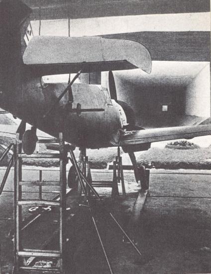
A Bf-109 on the firing butt at Gaël. Albeit overgrown, it still exists, as can be seen at the webpage of Philippe Saint-Marc.
From March to August 1944, the base was regularly attacked by the Americans and the British in an affort to drive the Germans off the base. They finally succeeded on 3 August 1944, when American troops commanded by General Patton liberated Gaël. Their 850Engineer Aviation Battalion repaired the base as a fighter/bomber base and renamed the airfield Advaced Landing Ground A-31 'Gael'. The airfield was then used by the 354 Figther Group, operating P-51 Mustangs between 13 August and 15 September 1944. The airfield closed and was released to French control on 28 September. 
March 1945 aerodrome map made by the French Air Ministry (via Phillippe Saint-Marc).


 Gael Point-Clos (A-31)