 Munchhouse
Validation date: 18 11 2013
Updated on: 22 10 2016
Views: 6061
See on the interactive map:
47°51'53"N 007°25'24"E
Runway: 17/35 - 1850x20m - asphalt/ tarmac
Munchhouse airfield (commonly known on the internet as "l'ancienne piste militaire de Munchhouse") was a small airfield about 7 kilometers south of Colmar-Meyenheim air base.
Very little is known of the airfield, which appears to be of a unique type in France. Even at French aviation websites very little can be found. What is known (from arial photography) is that the runway was built between 1951 and 1961. In 1961 photography, a bomb storage area seems to be (almost) completed to the northeast side of the runway. Between 1961 and 1966 taxiways were added on the southern end of the runway, along with 4 trapezoid shaped fighter parkings, a square fighter size parking and a platform capable of handling a C-130/C-160 sized transport.

In June 1951 nothing indicated this was to the site of a small airfield (IGN).

In IGN photography of 1961, a small runway and a munitions storage area were recognisable. There was no trace of a dispersal area yet, however (IGN).

By 1966, a dispersal area, with 4 fighter layouts and one general purpose layout, had appeared, along with a fairly large platform. In addition, a canal was dug along the road that crosses the runway. For about 50meters on either side of the runway, the canal was built over however, minimising the impact of possible runway excursions (IGN).

Enlargement of the dispersal area on above photo. Clearly visible are the dispersals, cut back foliage and the canal near the road, built over on each side of the runway (IGN)
By the end of the 1960s the airfield seems to have been abandoned by the Armée de l'Air. Closeups of 1973 photos of the dispersals reveal that they were getting patially overgrown. That situation had not improved by 1979.

Superficially, little had changed in this 1973 photo (IGN).

A close up of the 1973 photo revealed a lot of bushes were growing over the edges of the taxiways and dispersals, demonstrating not much maintenance had been done at the airfield over the past few years (IGN).

The airfield was still intact in 1979 (IGN).

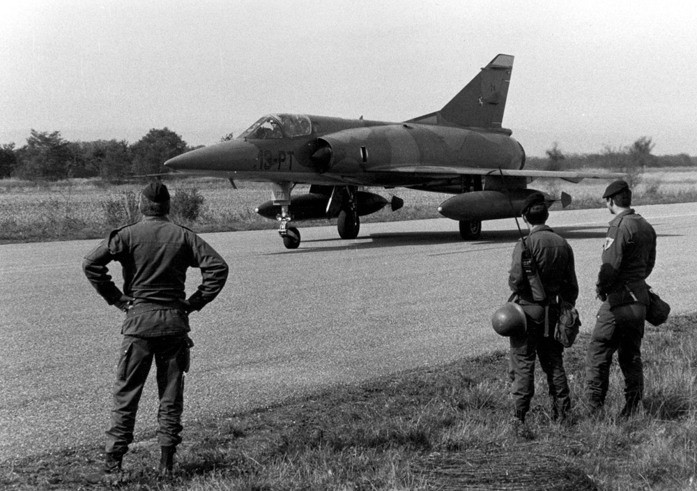
A large encircled 'H' and some runway lines appeared to have been painted on the runway at some point after 1979. Aircraft spotters active in the area in the 1980s cannot remember any activity taking place at the airfield, although this photo and a second one with Mirage 5Fs, claimed to have been taken in 1983, are shown on France-Air-OTAN.
In the 1990s the dispersal area was transformed in a receiver station for the Helios spy satellite network, known as Centre de Réception des Images Français (CRIF 11.348, part of the Escadron d'Observation par satellite 00.348), a Armée de l'Air unit reporting to Base Aérienne 132 Colmar-Meyenheim. Buildings and a large satellite dish were erected along with a triple fence around the complex. Alledgedly, the three rings of fences suggests that the inside ring was electrified.

The Helios receiver station in 2000, when it was supposedly still operational (BA132 website).

Badge of the part of the Escadron d'Observation par satellite 00.348, parent unit of CRIF 11.348 who operate the Helios platform.

A look down the runway in 2010 revealed a very faded encircled 'H' somewhere at the center of the runway (lud68 on Flickr, under Attribution-NonCommercial-NoDerivs 2.0 Generic (CC BY-NC-ND 2.0) ).
The station was decommissioned in the early 21st century. Aerial photography from 2004 showed that the satellite dish had already been removed by that time.

The airfield was still largely intact in 2011 (Google Earth)
In May 2013, Alsace rider François Gissy’s set a new world speed record on a bicycle doing 263kph on the old runway of the former Munchhouse aerodrome in Haut-Rhin (video on connexionfrance)
Olivier went to the airfield in the summer of 2015. He reported the runway is closed to all vehicles now and partially blocked (on the south side) by earth walls.

The runway facing north from the departmental D47.1 road. The road is closed "except rights holders" (Olivier).

View towards the dispersal area over the departmental D47.1 road. Again, the runway is blocked by earth walls and a red/white barrier halfway to the dispersal (Olivier).